Huguenot Hundred Community Association
Chesterfield County Seal
Menu
Home
History
Governance
Contacts & Maps
  Board of Directors
  Committees
  Members Directory
  Web Maintenance
  Neighborhood Map
  Trail Map
  Flood Map
  Reservation Form
News & Calendar
  News Archive
  News & Events
  Photo Album
  Lost & Found
  Sewer Issue
Finances
  ANNUAL DUES
  Bank Statements
  Budget and Fees
  Financial Reports
  Tax Returns
  Insurance
Archives
  Annual Meetings
  Board Meetings
  HHCA Documents
Interesting Links

 100-Year Flood Map (Revised 11-29-2011)
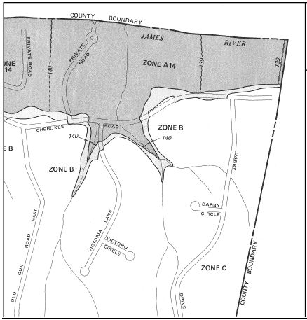
The elevation 140 ft asl (above sea level) is defined as the 100-Year Flood elevation. For more information on flooding and water levels click on the links below:

     1. Definition of 100-Year Flood
     2. James River Water Levels at Westham Gage
     3. Flood History and Details
     4. Calculate elevation based on Westham Gage readings (Revised 11-29-2011)


Site design by John Harlow